Superior Accuracy
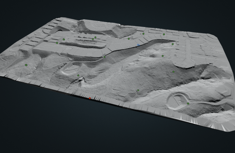
A DEM (Digital Elevation Model) and Contours allow you to get accurate insight into the ground topography. The first step in creating these accurate deliverables is to classify the ground using the ROCK Cloud AI Engine.
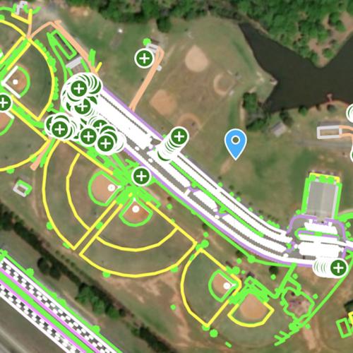
Once the ground is accurately determined, then a DEM and contours can be generated. Contour lines are delivered in the most popular formats so you can import into any CAD or GIS software packages. Additionally, you can view the contours right on the ROCK Cloud!
Classification Options:
- Ground Only
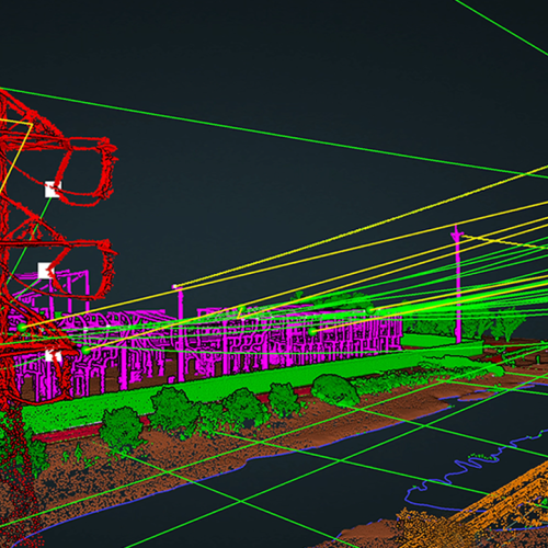
- Enhanced Classification - Ground, Buildings, and High Vegetation
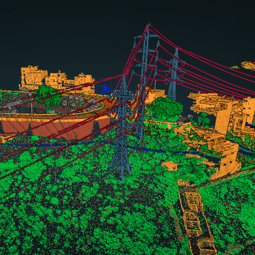
- Enhanced Classification Plus - Ground, Buildings, vegetation, Roads, Water, Bridges, and Transmission
Add-ons:
- Breaklines for enhanced contour accuracy
- Strip Alignment for increased point cloud accuracy
Deliverables
- Ground Classified laz file
- SHP file containing geometry data
- DBF attribute format file
- SHX shape index file
- DEM in TIF format
- Accuracy Report